Finding and agreeing access for a new site
Identifying a new site
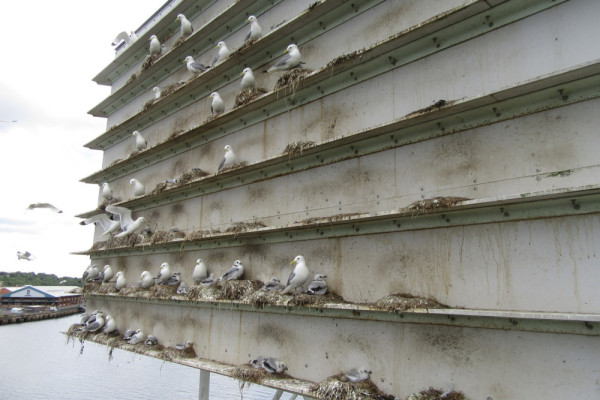
The first step to ringing seabirds (once you, or the ringer-in-charge of the project, have the necessary ringing permit and endorsements in place) is finding them! You may be lucky and already have a site or colony in mind for your seabird ringing, be that a pair of gulls nesting on your roof, an inland tern raft, a remote seabird island or a coastal colony. If so, great, but how do you find out whether anyone is already ringing there and how do you gain permission to access the site? And if you are not aware of any sites, where do you start looking?
The first thing to do when considering seabird ringing is to think about your options (and be realistic with this). If you don’t already have a clear picture of what species you want to monitor, deciding how far you are willing to travel could help to narrow down the list of species that you can access. If where you live isn’t a restrictive factor, choosing which species you want to target is a sensible first step to identify potential ringing sites.
Once you have a clear idea of what you want to target and how far you are willing to travel to do so, a good place to start looking for a site is to ask your ringing colleagues whether they are aware of any local sites that are not actively monitored. If that doesn’t provide any useful leads, there are a variety of other resources you can use to start to look for seabird sites.
Resources for finding sites
Seabird Monitoring Programme map
The Seabird Monitoring Programme (SMP) collates data on breeding abundance and breeding success on an annual basis. There is a useful interactive map which shows all the seabird sites across Britain and Ireland that have, or need, volunteers undertaking surveys. From this map you can request data including whole-colony counts undertaken as part of comprehensive periodic censuses: Operation Seafarer (1969-1970), Seabird Colony Register census (1985-1988), Seabird 2000 (1998-2002), Seabirds Count (2015-2021). In addition, information on Urban Gull censuses (1976 and 1993-1995), are also stored there. This map and database can be used to locate known seabird colonies and see what species are present in what numbers. Although many of these sites will have ringers already operating there (and this resource does not identify whether that is the case or not), it might help to identify potential sites which you could then investigate further.
WeBS online
The Wetland Bird Survey (WeBS) is the principal scheme for monitoring the UK’s waterbird populations, providing an important indicator of their status and the health of wetlands. Maximum counts for all sites, species indices and trends by country, low tide distribution maps, site totals for principal sites and minor sites and more are available on the WeBS Report Online interface. This tool is primarily for waterbirds so does not include all seabird species, but can be used to help identify sites for gulls (including Kittiwake), terns, Cormorant and Shag. Please note WeBS covers England, Northern Ireland, Scotland and Wales but not the Republic of Ireland.
I-WeBS
The Irish Wetland Bird Survey (I-WeBS) is the equivalent wetland bird monitoring scheme for the Republic of Ireland. As above, there is an interactive map that could be used to help identify potential sites for some species.
Bird Atlas Mapstore
Every 20 years or so volunteer birdwatchers carry out a complete stock-take of the birds of Britain & Ireland for the Bird Atlas. The Map Store contains maps for all the species from these atlases showing information on distribution and change. It is not possible to zoom into these maps to see information at site level, but they are a good starting point to see whether a species occurs in your area of the country, to get a rough idea where the species occurs in the highest densities and to see how populations have changed over the years.
Gaining permission for a new site
Regardless of its scientific importance, all ringing data must be collected legally, with the necessary access permissions in place. Ringing permits allow ringers to catch birds and to fit BTO rings to them, but do not convey any right of access so, while ringers can theoretically ring birds and monitor nests on private land anywhere in Britain and Ireland, permission must be secured in advance. Permission does not need to be in writing but it is advisable to have a written record in case of subsequent disputes. Identifying the correct person to seek permission from can be challenging. Ideally, you should contact the landowner themselves, but a tenant farmer, gamekeeper or estate manager may also give valid permission if the landowner can’t be identified or contacted.
In England, Wales and Scotland the MAGIC map application can sometimes be helpful in identifying a landowner or responsible body. If the site is designated as a marine SPA for instance, clicking on a site using the ‘I’ (information) tool (while the relevant Designations layers are ticked) can sometimes tell you who is responsible for a site e.g. NatureScot. In England, information for land that is in an environmental stewardship scheme may show the name of the business or landowner (while the relevant Land Based Schemes layer is ticked), which can be used as a starting point for identifying a contact. If the landowner cannot be identified using online tools, asking locally might point you in the right direction. Alternatively, information on land ownership can be obtained from the Land Registry, although there is usually a fee for this service.
Ringing on designated sites
There are a number of protected site designations in Britain & Ireland:
- Sites of Special Scientific Interest (SSSIs, ASSIs in Northern Ireland, NRAs in Republic of Ireland)
- Special Protection Areas (SPAs)
- Special Areas of Conservations (SACs)
- Agency-managed National Nature Reserves (NNRs)
The landowner (or equivalent) of the site in question should be able to tell you whether the site is designated; however, it would be prudent to check this yourself in advance of seeking permission to ring there. The location and (in most cases) the boundaries of designated sites can be identified in England, Scotland and Wales via the MAGIC map application, in Northern Ireland via the Natural Environment Map Viewer, in the Republic of Ireland via the NPWS Protected Sites map viewer and in the Isle of Man via the Isle of Man Government Protected Sites web page.
Any ringer wishing to undertake ringing activities on a designated site will require specific permission from the relevant Country Agency (Natural England, Natural Resources Wales, NatureScot, the Department of Agriculture, Environment and Rural Affairs, Northern Ireland, the National Parks and Wildlife Service, Ireland, the Manx Department of Environment, Food and Agriculture). It is the responsibility of the landowner to secure this permission, but as it is a legal requirement that it is in place, ringers should always ensure that the landowner has acquired this permission before starting ringing at a site.
For nature reserves run by other organisations (e.g. RSPB, Wildlife Trusts, National Trust, Ministry of Defence), ringers should seek permission from the appropriate member of their staff (note, this often requires approval at a higher level than the reserve warden but they may be a good place to start). If these sites are also a designated site, permission from the relevant Country Agency will also be needed.
Land access
Neither the ringing permit nor the licence to catch wild birds for ringing gives any right of entry onto land or permission to ring without the landowner’s consent where this is necessary. As such, ringers should always ensure that access to land is lawful under the relevant land-access legislation. See Ringing permits explained for details of the access legislation in each country and Access and permission to ring in Scotland for Scottish-specific guidance.
Catching at sea
Ringing offshore, from a boat or oil platform for instance, may not be covered by the BTO ringing permit and may require additional permissions to be obtained by the relevant authority in the country in question. Please contact the Ringing Licensing team for advice if this is relevant to your project.
Asking the right questions of the landowner
Once a landowner or equivalent has been identified, there are a number of questions you might want to ask in addition to ‘can I ring here please?’ and ‘is the site designated?’.
The landowner or equivalent may ask to see your ringing permit, so always have a copy of this handy, either on paper or on a mobile device. You may also be asked for proof of adequate insurance. Details of insurance covering ringers can be found on the BTO website (access to this page is restricted to ringing permit holders only). Some landowners may also ask you to complete a risk assessment before they grant access to their site.
Where appropriate, you may also wish to invite the landowner or equivalent to observe or be a part of the ringing operation. This can help to foster good relationships, might provide you with an on-site colour-ring resighter (where relevant) and may even result in them joining the Ringing Scheme.
Potential questions for landowners or land managers
Does anyone else already ring/monitor the birds on site?
The landowner or equivalent should be able to answer this question but see ‘Coordinating with other ringers’ below. It is always worth finding out about other surveyors that have access to the site in addition to ringers and trying to coordinate activities with them where possible. For instance, if the site is monitored for WeBS, it would be considered polite to ensure that you are not disturbing the birds on site when the WeBS counter is trying to count them!
Does anyone else need to give access permission?
The landowner may not be the person who is on site on a daily basis and a tenant farmer or warden for instance might be the more appropriate person to contact for access. The landowner should be able to provide contact details in this situation.
Is there any public access to the site?
Whether or not there is any public access to the site might inform the type of ringing you want to undertake on site and when. For instance, disturbing a gull or tern colony on a busy nature reserve in the middle of the day on a weekend might not be ideal, accessing the colony early in the morning on a weekday, before most visitors arrive, might be more appropriate. Knowing if a site has public access will also enable you to plan appropriately for the size of the team needed to undertake the ringing and any resultant public relations with passers by.
Do you need to let them know each time you go on site?
Some landowners or tenants will need you to inform them of your intention to be on site each time you wish to visit. There may be a number of reasons for this; common courtesy, in order to ensure no conflicting activities are planned at the same time e.g. shooting, or so they are not worried by approaching vehicles at unsociable hours for instance.
Do they want a report at the end of the season?
Some landowners or equivalents will ask for, or be grateful for, a report at the end of each year outlining the monitoring that has taken place and listing the results of your ringing activities. Some may use this to support their agri-environment schemes, others may just request this for their own interest.
Are they aware of any sensitive species breeding there (Schedule 1 species)?
It is always worth checking whether the landowner or equivalent knows of any Schedule 1 (Schedule 2 in the Republic of Ireland) species that are breeding on site. Whilst a limited number of seabirds fall into this category, other species of birds that do may nest nearby. The presence of such species might restrict your access to some or all of the site in the breeding season and it would be useful to know this in advance of you planning any monitoring activities on site. The list of Schedule 1 / Schedule 2 species can be found here. Information on how to obtain a Schedule 1 licence can be found on the Seabird ringing licensing requirements page.
Coordinating with other ringers
It is very important to remember that the person who decides what monitoring work happens at a site is the landowner or equivalent. No ringer can prevent another from operating nearby if the landowner has approved it, but it is obviously to everyone’s advantage, and particularly that of the birds, if everyone works in a coordinated manner, maintaining good communication throughout. When planning to ring at a novel site, particularly one away from your regular patch, it is still important to make sure activities aren’t going to impinge on those of other volunteers. While it might be expected that landowners will make potential ringers aware of other volunteers accessing their property, nothing is lost by double-checking.
If you are at all unsure as to whether a site is already monitored, and the landowner or equivalent is unable to confirm this, staff in the Ringing & Nest Recording Team should be able to identify whether any ringing is occurring at your proposed site and by whom. If other ringers are already monitoring the site, they may be more than happy to have an extra pair of hands helping with their project, so it would be worth contacting them to ask if you can assist. Again, the Ringing & Nest Recording Team can help facilitate contact if necessary. Please email the Ringing Team in the first instance to ask for assistance.








Share this page